|
April 2, 2024 - 2:00 pm update: - TUESDAY AFTERNOON - The official Michigan snowmobile season came to a close on Sunday, March 31, 2024. However, the weather forecast is calling for heavy snow starting Tuesday night into Thursday for the Central and Western parts of the Upper Peninsula. Snow totals may be as much as 2 feet in the high country west of Marquette. You can still ride on public land, however, please make sure you know that any place that you ride is public and open for riding. Do not trespass. Trespassing and riding on trails that are not open causes great harm and sometimes means the closing of trails for good.
Check the weather page for the latest weather updates
Check the snow depth map for the areas the have the most snow.
Here are the latest trail reports.
Check back for updates.
<>
Here's a look at the totals via the Snow Depth Map.
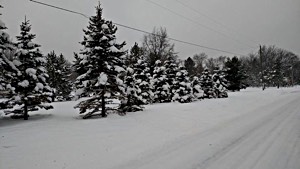
If you want to see some of the latest snow click here for the latest photos.
If you want to keep track of the weather forecast Check the weather page for the latest weather updates
And then check back all season long for updates on snow, weather and trail conditions. Have a great week!
Here's the Snow Depth Map to help you find regions with the most snow.
Keweenaw Peninsula
--
Ironwood / Western U.P.
Ontonagon / Western U.P.
Munising Area
Seney Area
--
Newberry Area
WEATHER NEWS: Here a look at the snow in the forecast for this week and the upcoming weekend via the John Dee Graphic Forecast.
Check back later for more updates...
Check the weather page for the latest weather updates and click here for the latest photos.
Check the Snow Depth Map for areas with the most snow.
You can keep track of the snow in the forecast by checking out the Radar Loop
Here are the latest trail reports.
Check out John Dee and the John Dee Forecast Graphic for his take on this week's weather.
Latest Snow Photos - 2022
Complete trailreport.com reports on the web, facebook and twitter:
FACEBOOK - http://www.facebook.com/TrailReport
TWITTER - http://www.twitter.com/TrailReport
Forecasts
from
Weather
Undergound:
(Ironwood
Forecast)
--
(Marquette
Forecast)
--
(Newberry
Forecast)
--
(Cadillac
Forecast)
--
(Gaylord
Forecast)
--
(Traverse
City
Forecast)
NEW:
Webcam
Map
-
View
webcams
throughout
Northern
Lower
Michigan
and
the
Upper
Peninsula
on
our
interactive
google
map.
You
can
follow
the
week's
weather
forecast
at
John
Dee.
You
can
track
some
of
the
lake
effect
snow
on
the
Radar
Loop
here
and
also
get
an
educated
guess
on
the
best
regions
for
snowfall
on
the
Winter
Storm
Warning
Map.
You
can
view
the
snow
depth
map
here.
To
check
temperatures
and
trail
conditions
throughout
Northern
Lower
Michigan
and
the
Upper
Peninsula
click
on
our
new
google
interactive
trail
report
map
|


